
1.2.5. Cartography of the Czech lands
Oldest maps of the „Lands of the Czech Crown“
BOHEMIA – Claudianus Map (1518)
Drawn by Nicolas Claudianus (1518), published in Nürnberg, Germany. Approximate scale is 1:637 000. Oriented to south. Contains 280 towns divided according to ownership (king / nobility) and religion. The map itself occupies only the lower third of the sheet, the upper two thirds contain coats-of-arms of aristocratic families.
The map was discovered in a monastery in Litomerice, Czech Republic.
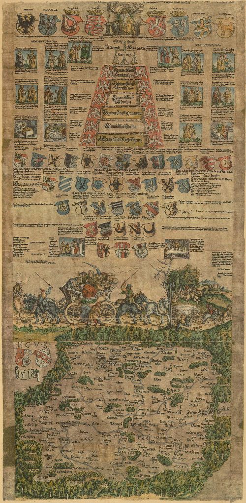
Fig.2.4: Claudianus Map from 1518
MORAVIA - Fabricius Map (1569)
Contains Moravia and part of Lower Austria (to the Danube River). Paul Fabricius was a doctor, mathematician and cartographer from Vienna, Austria. Names of towns contained in map are sometimes mutilated. The approximate scale is 1:288 888, reference geographical grid is present. Engraved into 6 copper plates. Only one incomplete printout is preserved in the Czech Republic. The map was contained in Ortelius Atlas.
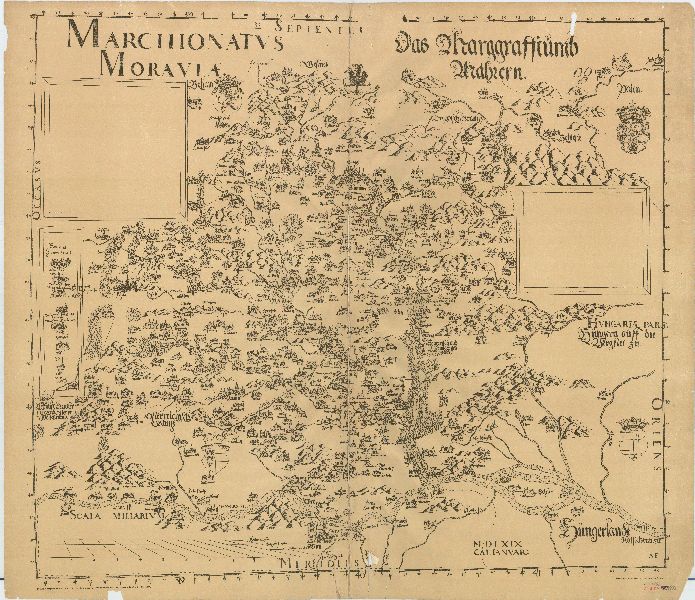
Fig.2.5: Fabricius Map from 1569
SILESIA - Helwig Map (1561)
Engraved in wood in 4 sheets. Approximate scale is 1:550 000. Contains reference geographical grid. The map is richly decorated, oriented to south (so that the Odra River flows from Upper to Lower Silesia – down from top.) Contained in Ortelius Atlas.
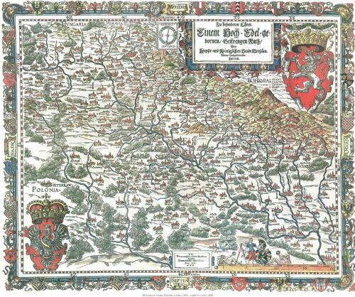
Fig.2.6: Helwig Map from 1561
